My backpack
You don't have anything in your backpack at the moment.
Add destinations, sights and events by clicking this icon on individual pages:
![]()
Packed everything? Then send the backpack to yourself or your companion and set off.
You don't have anything in your backpack at the moment.
Add destinations, sights and events by clicking this icon on individual pages:
![]()


No. 10 - Haversberg
Location: Alter Weseler Weg / Granatstrasse
PDF hiking map
Car spaces: approx. 33
Path characteristics: forest paths, dirt roads, small road (suitable for prams)
Landscape: forest, open field (hilly)
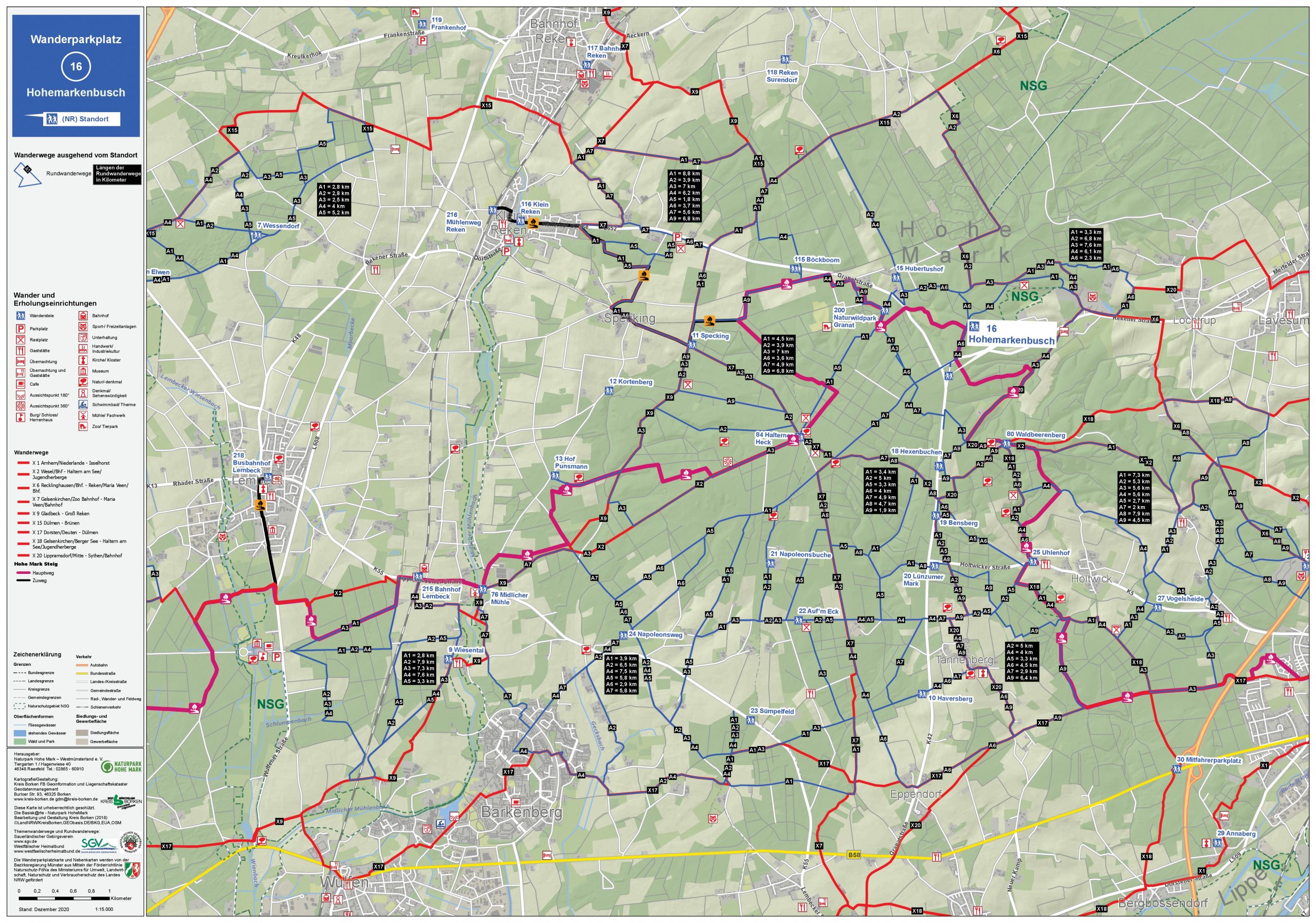
No. 16 - Hohemarkenbusch
Location: Garnet Street / Rekenhe street
PDF hiking map
Car spaces: approx. 25
Nature of the path: forest paths (not suitable for prams)
Landscape: forest, open field (hilly)
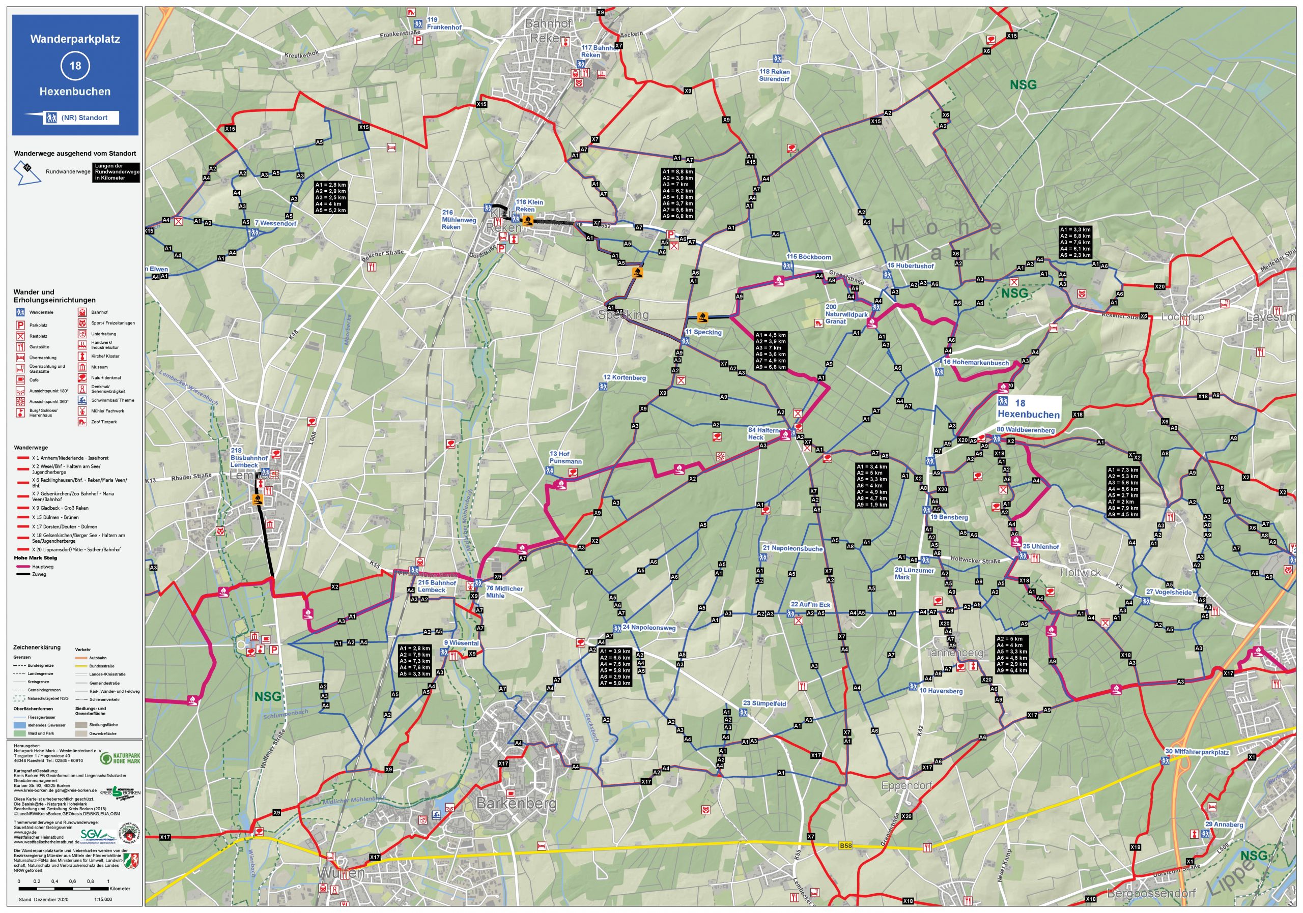
No. 18 - Hexenbuchen
Location: Granatstrasse, north of the Hexenbuchen
PDF hiking map
Car spaces: approx. 16
Nature of the path: forest paths (not suitable for prams)
Landscape: forest, open field (hilly)

No. 19 - Bensberg
Location: Granatstrasse
PDF hiking map
Car spaces: approx. 15
Nature of the path: forest paths (not suitable for prams)
Landscape: forest, open field (hilly)
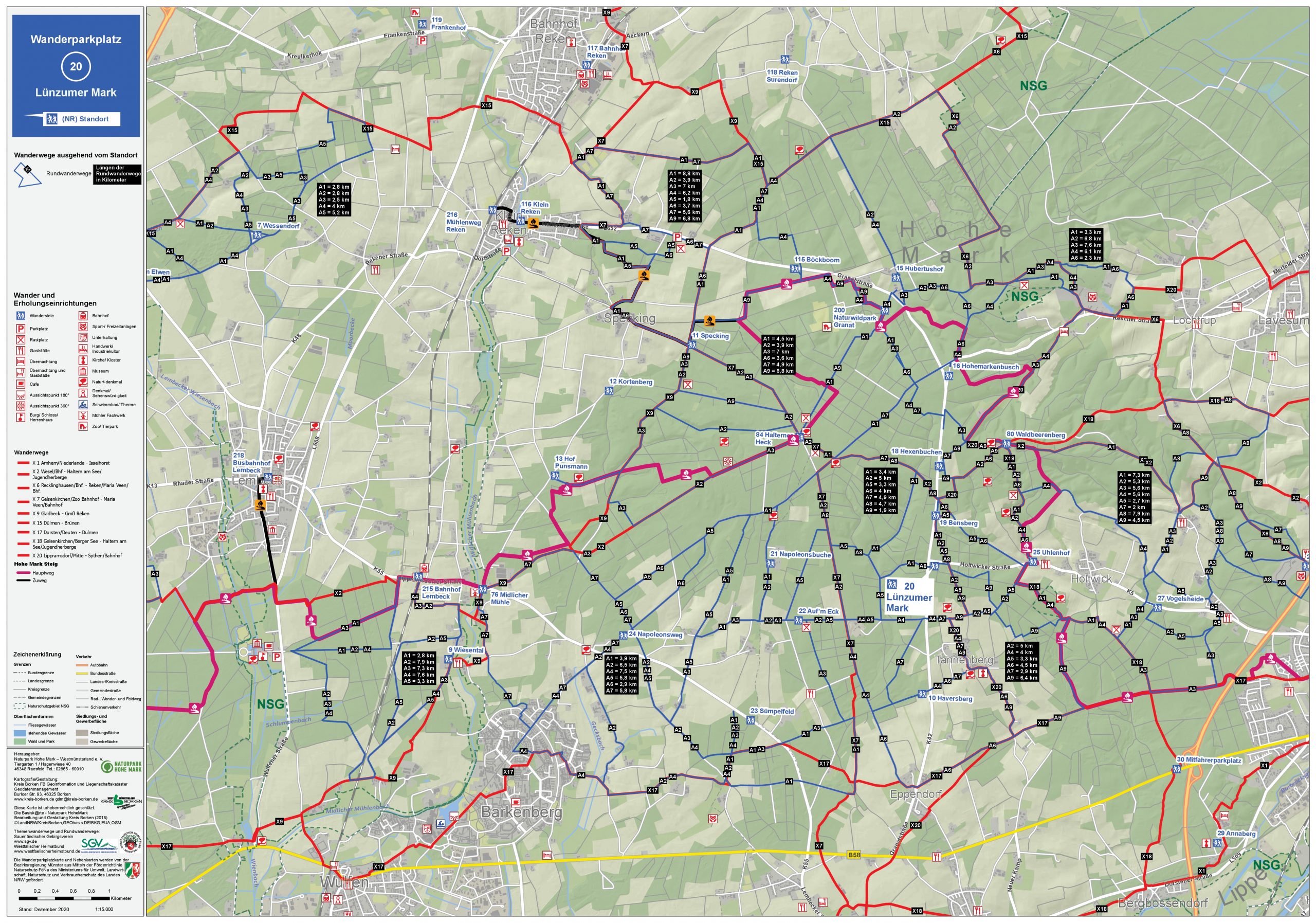
No. 20 - Lünzumer Mark
Location: Granatstrasse / Holtwicker Strasse
PDF hiking map
Car spaces: approx. 31
Nature of the path: forest paths (not suitable for prams)
Landscape: forest, open field (hilly)
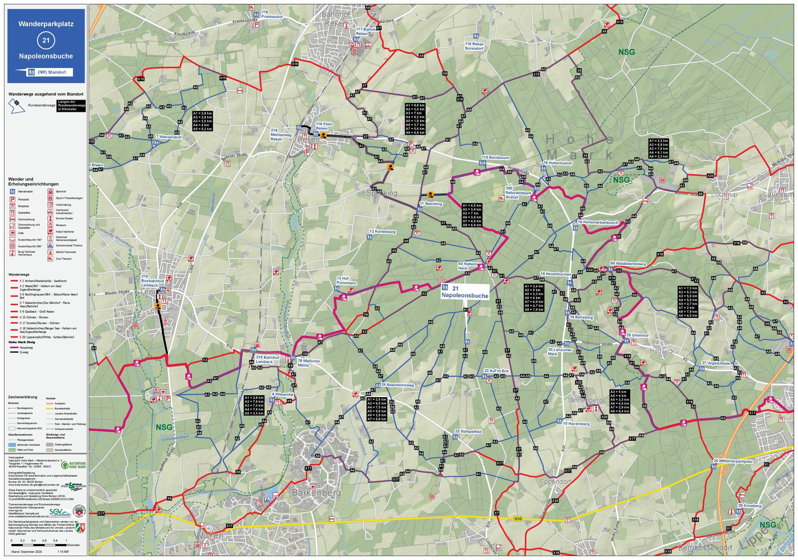
No. 21 - Napoleon beech
Location: Im Holt
PDF hiking map
Car spaces: approx. 70
Path characteristics: forest paths, dirt roads, small roads (mostly suitable for prams)
Landscape: forest, open field (hilly)
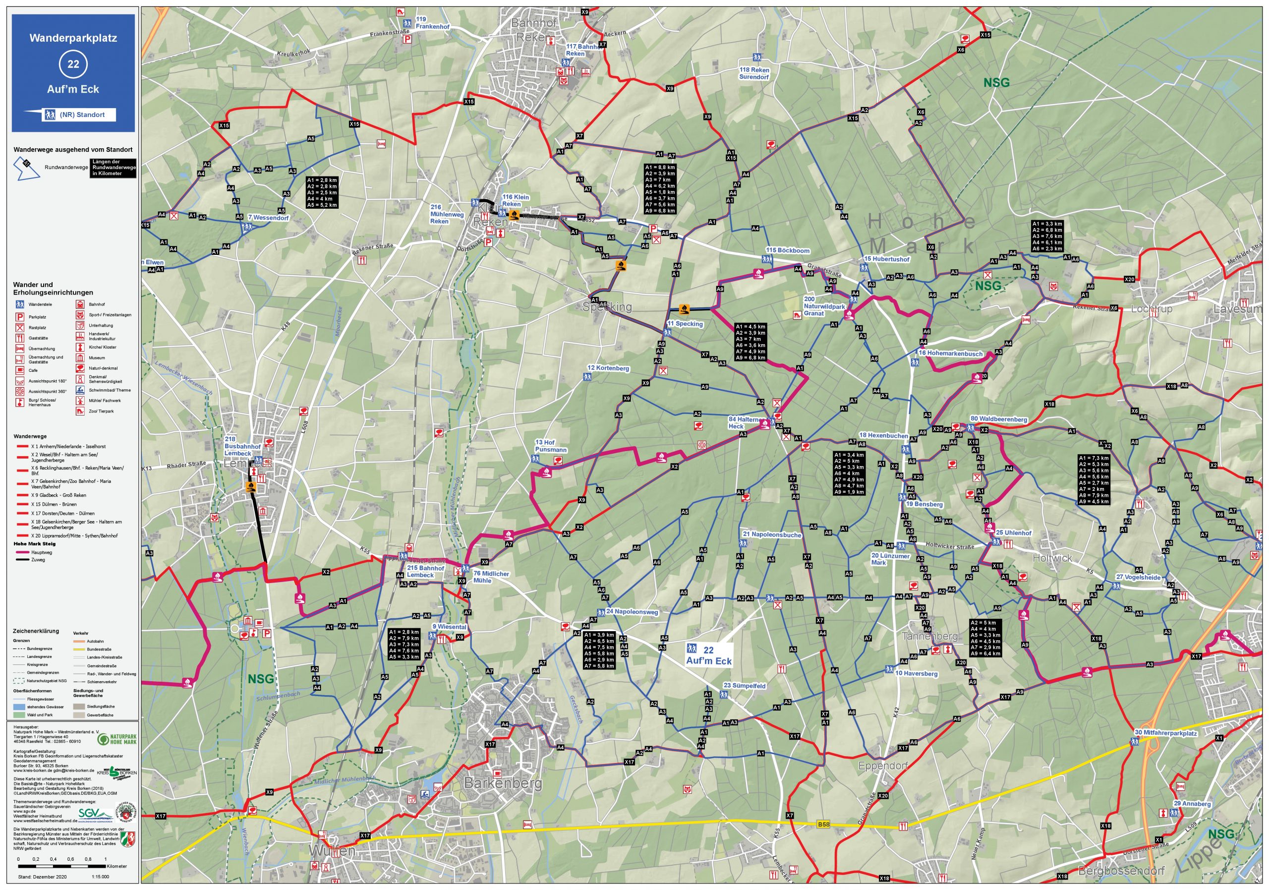
No. 22 - On the corner
Location: Right in Holt / direction Auguste-Viktoria 9
PDF hiking map
Car spaces: approx. 60
Path characteristics: forest paths, dirt roads, small roads (mostly suitable for prams)
Landscape: forest, open field (hilly)
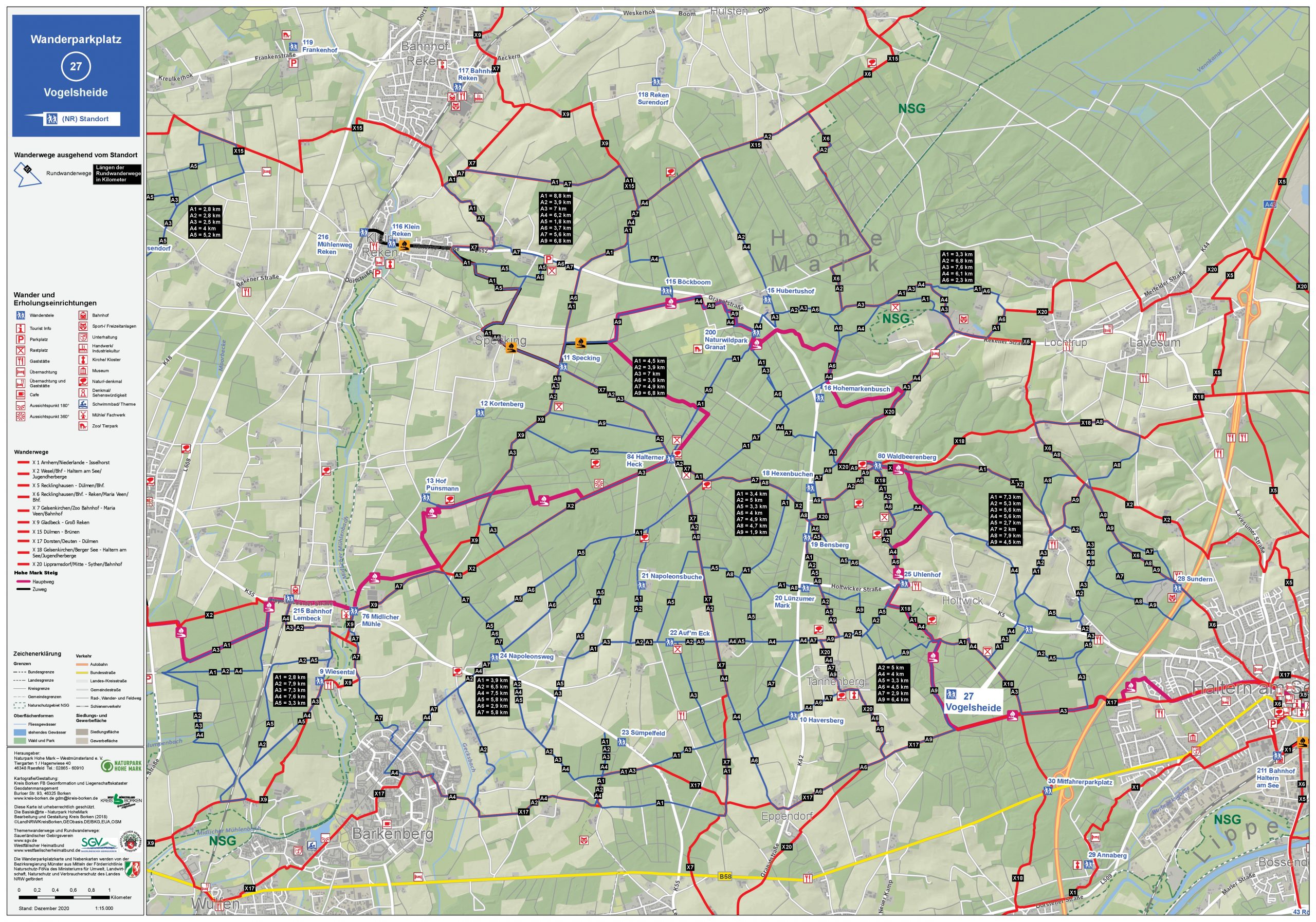
No. 27 - Vogelsheide
Location: Holtwicker Strasse
PDF hiking map
Car spaces: approx. 28
Path condition: forest paths (partly suitable for prams)
Landscape: forest, open field (hilly)
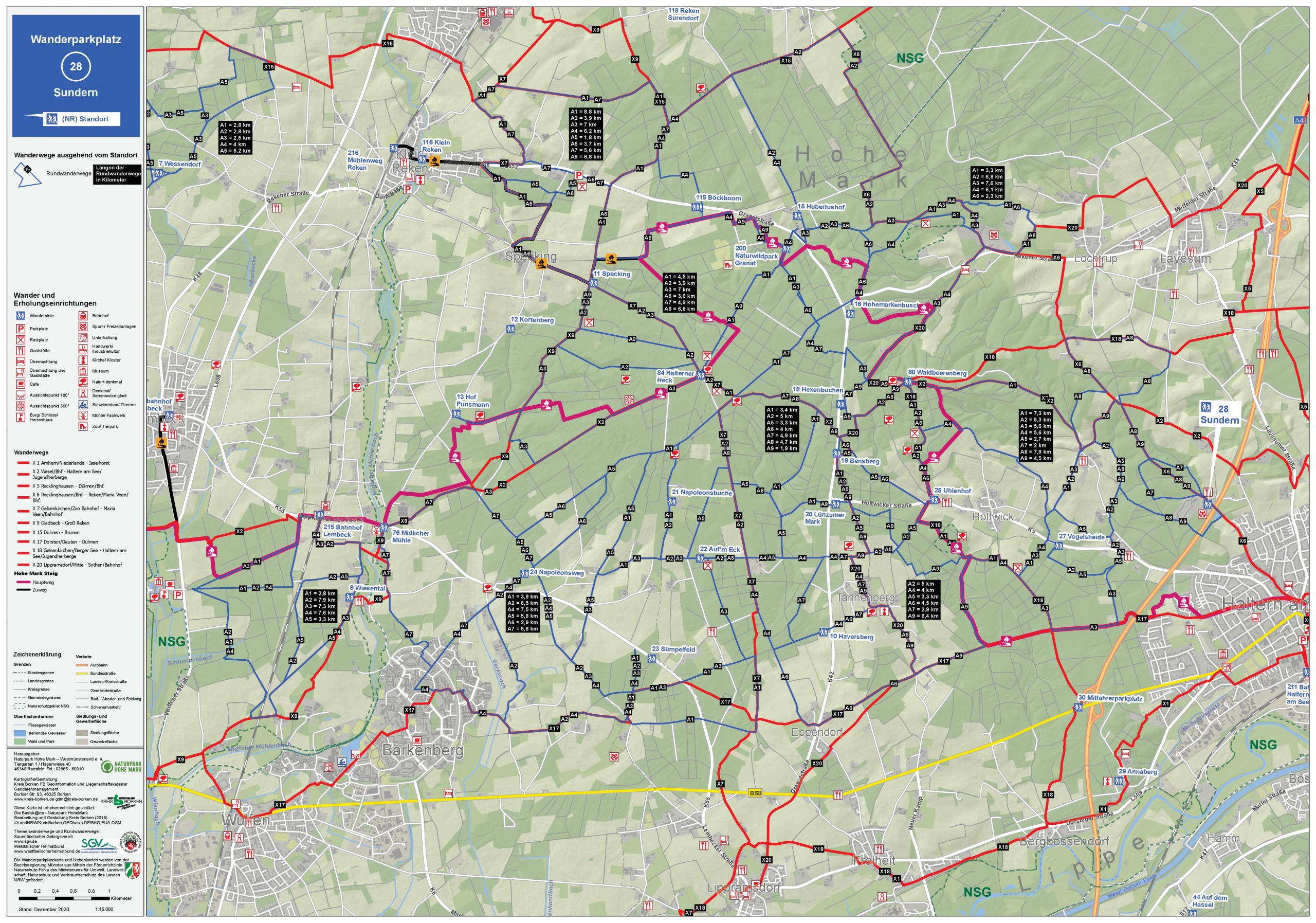
No. 28 - Sundern
Location: Sundernstrasse, at the forest cemetery
PDF hiking map
Car spaces: approx. 52
Path characteristics: forest paths, dirt roads, small road (in the forest mostly suitable for prams)
Landscape: only falst forest (hilly, near town)

No. 83 - Westruper Heide
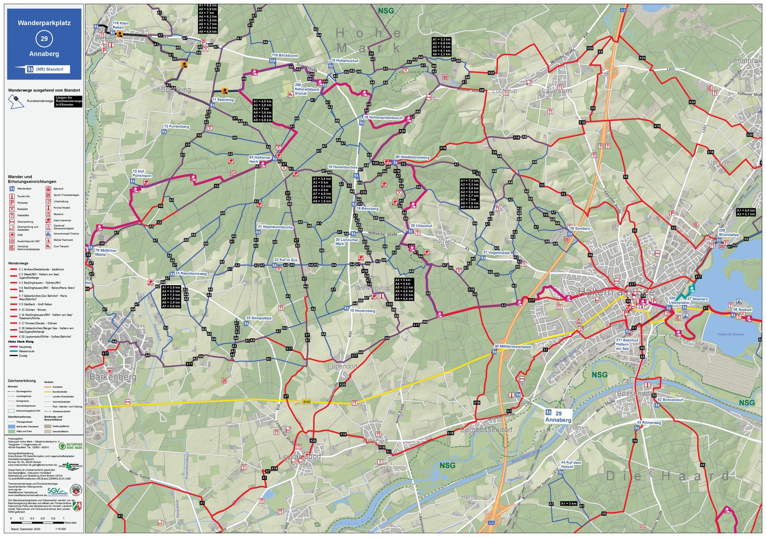
No. 29 - Annaberg
Location: Annaberg
PDF hiking map
Car spaces: approx. 100
Path characteristics: forest paths (mostly suitable for prams)
Landscape: forest, open field (slightly hilly)
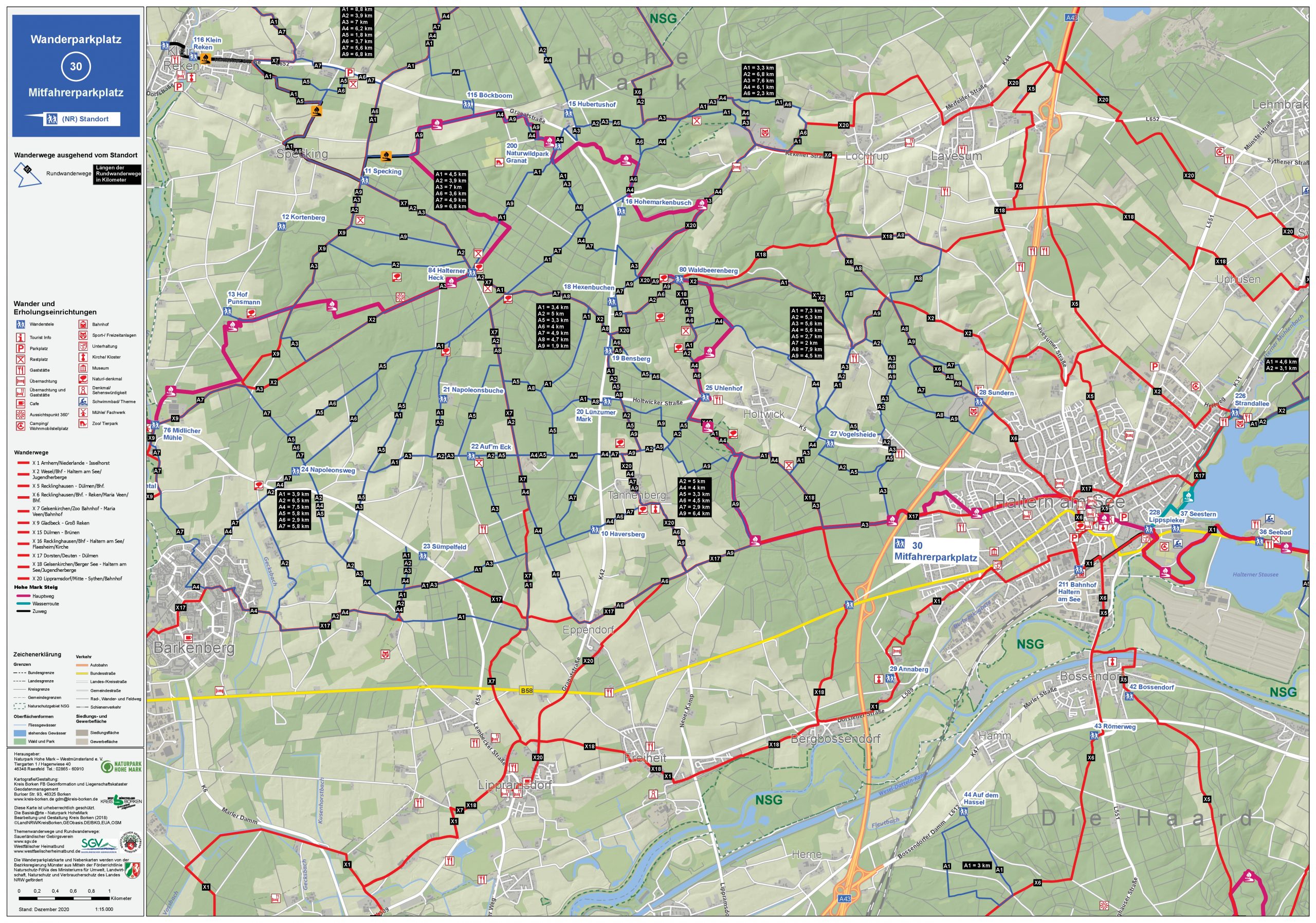
No. 30 - passenger parking
Location: Weseler Straße (B58 / A43)
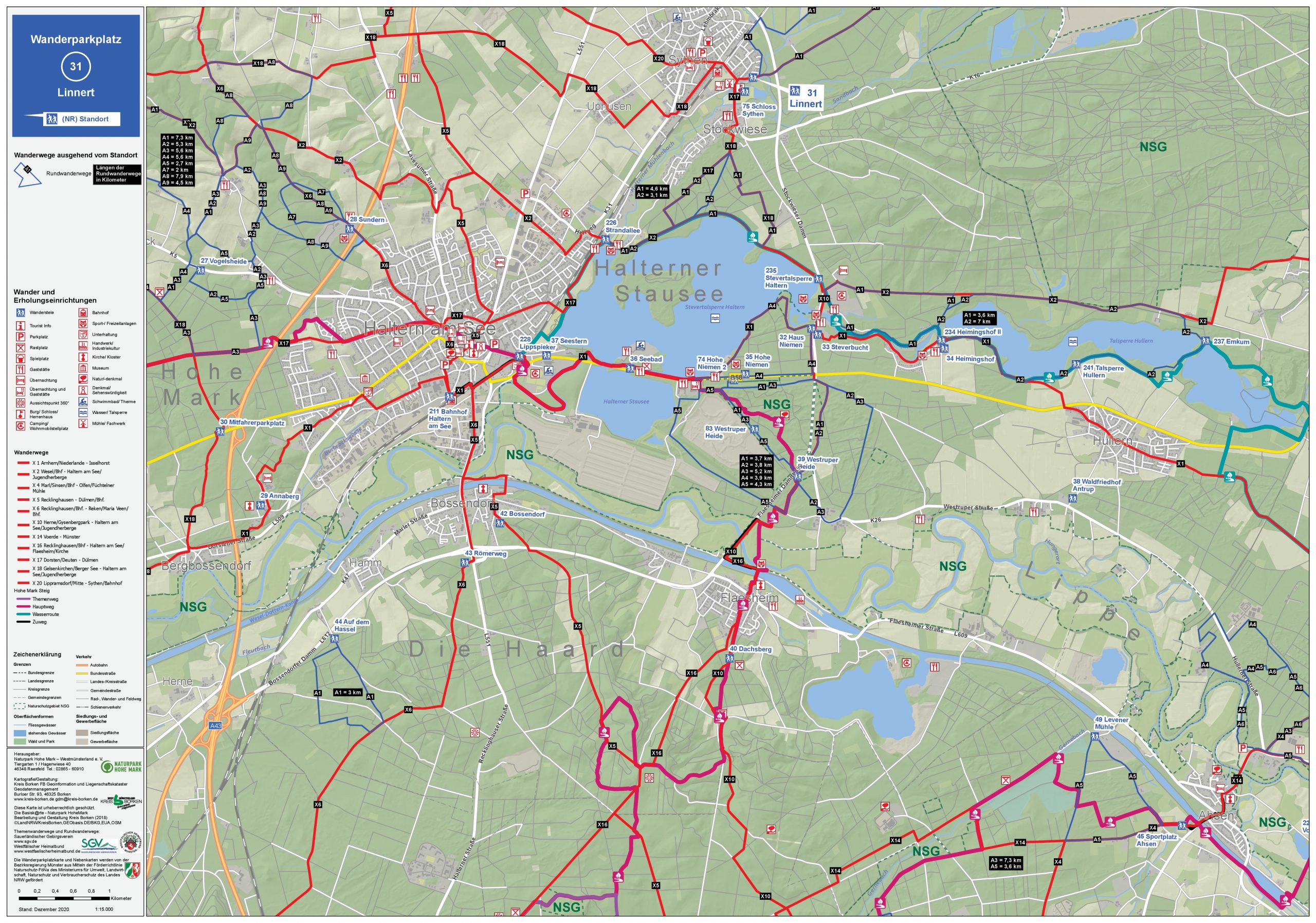
No. 31 - Linnert
Location: Zum Linnert
PDF hiking map
Car spaces: approx. 26
Path characteristics: forest paths, small road (suitable for prams)
Landscape: forest, open field (flat, near town)

No. 32 - House Niemen
Location: Stockwieser Damm, south of the Antoniusbrücke
PDF hiking map
Car spaces: approx. 96
Path characteristics: forest paths, floodplain paths (suitable for prams)
landscape: forest, lake shore, SteveraueNext)
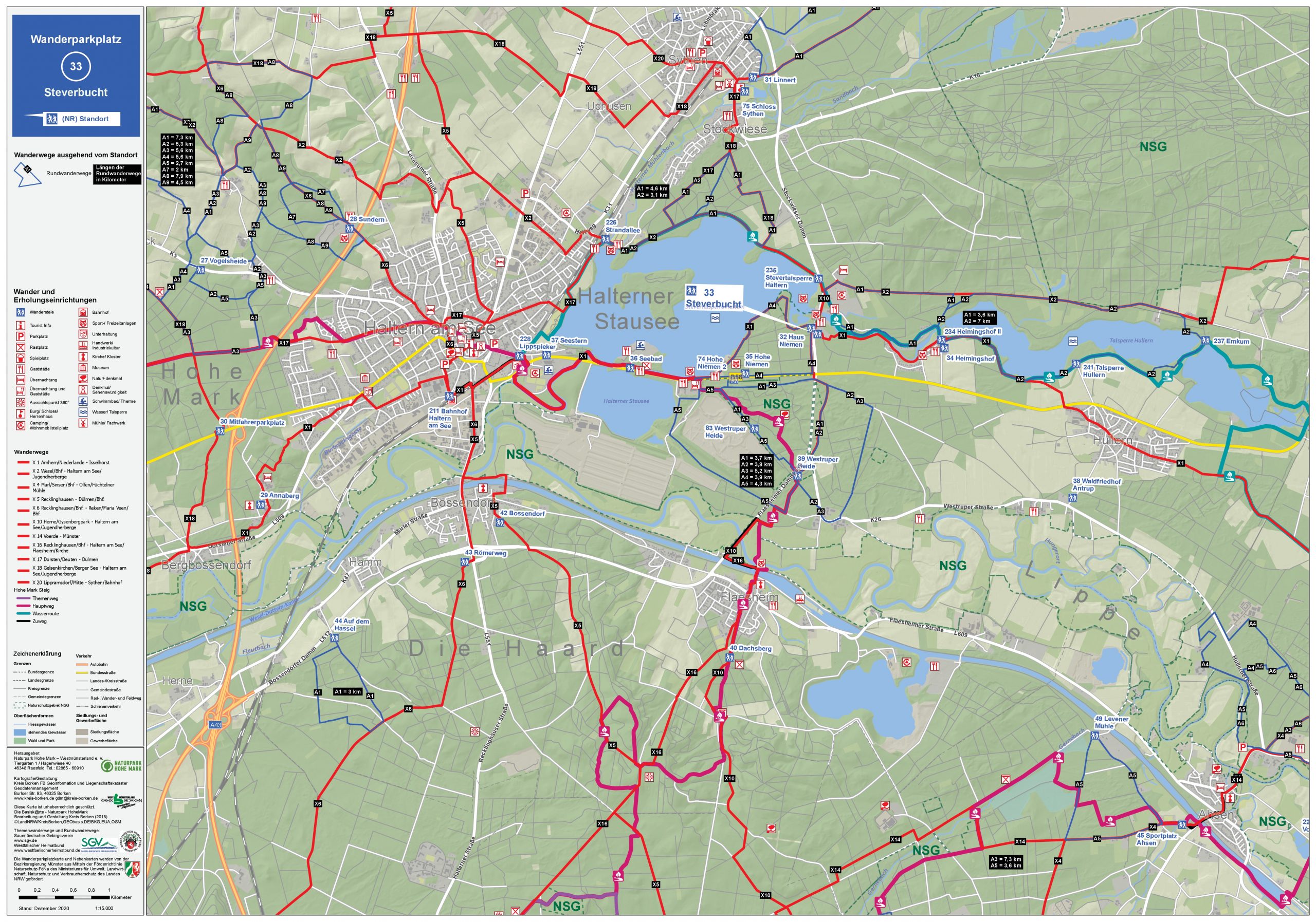
No. 33 - Steverbucht
Location: Stockwieser Damm, Lakeside Inn restaurant
PDF hiking map
Car spaces: approx. 200
Path characteristics: forest paths, floodplain paths (suitable for prams)
landscape: forest, lake shore, SteveraueNext)
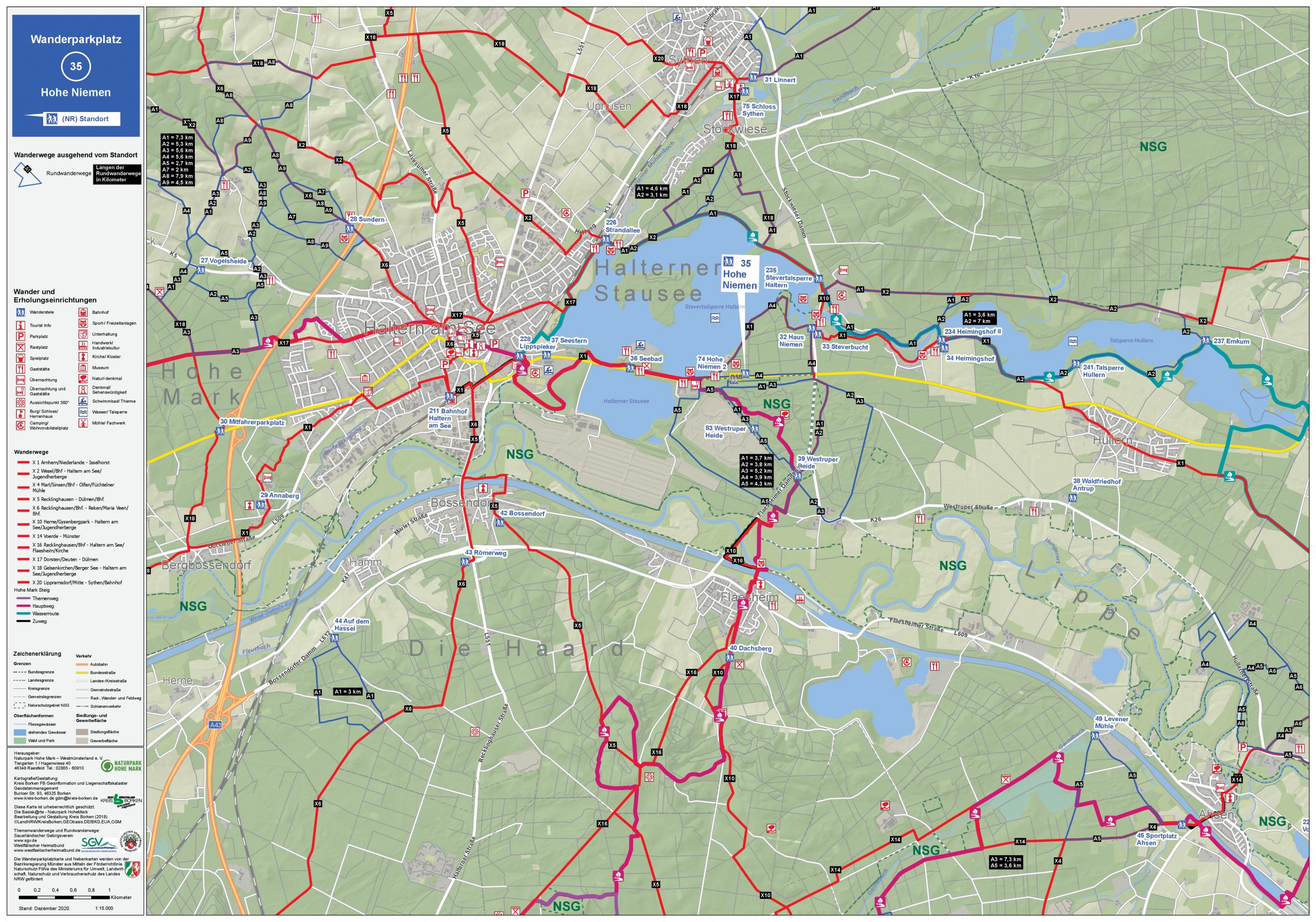
No. 35 - Hohe Niemen
Location: Hullerner Str. (B58), reservoir
PDF hiking map
Car spaces: approx. 101
Nature of the paths: forest paths, bank sweeps, sand paths (Westruper Heide) (outside of the heather suitable for prams)
Landscape: forest, heather, reservoirs, open field (flat)

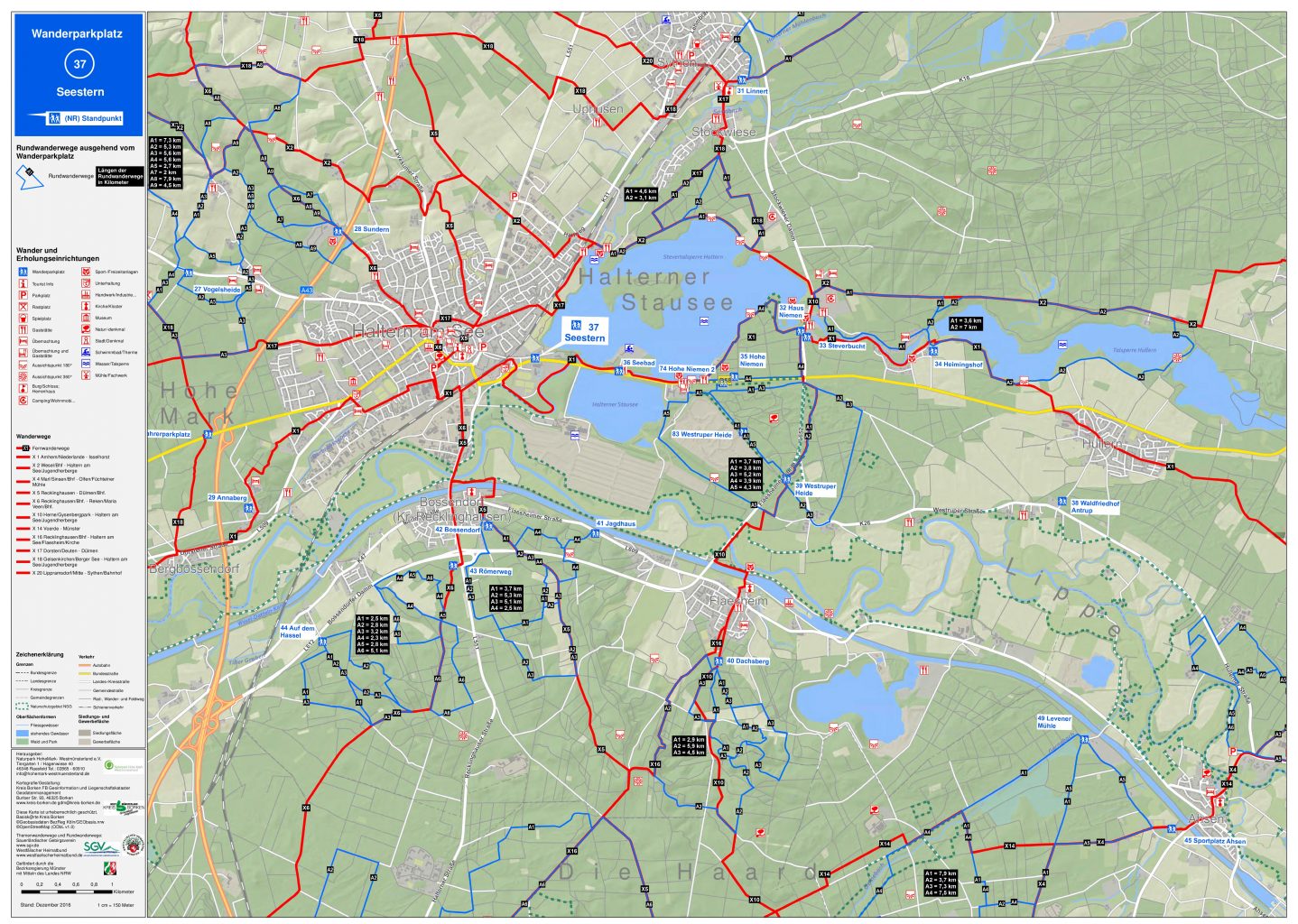
No. 37 - starfish
Location: Hullerner Str. (B58), reservoir
PDF hiking map
Car spaces: approx. 145
Nature of the paths: lakeshore paths, floodplain paths, Steveruferweg (suitable for prams)
Landscape: lake meadows, river meadows (flat)
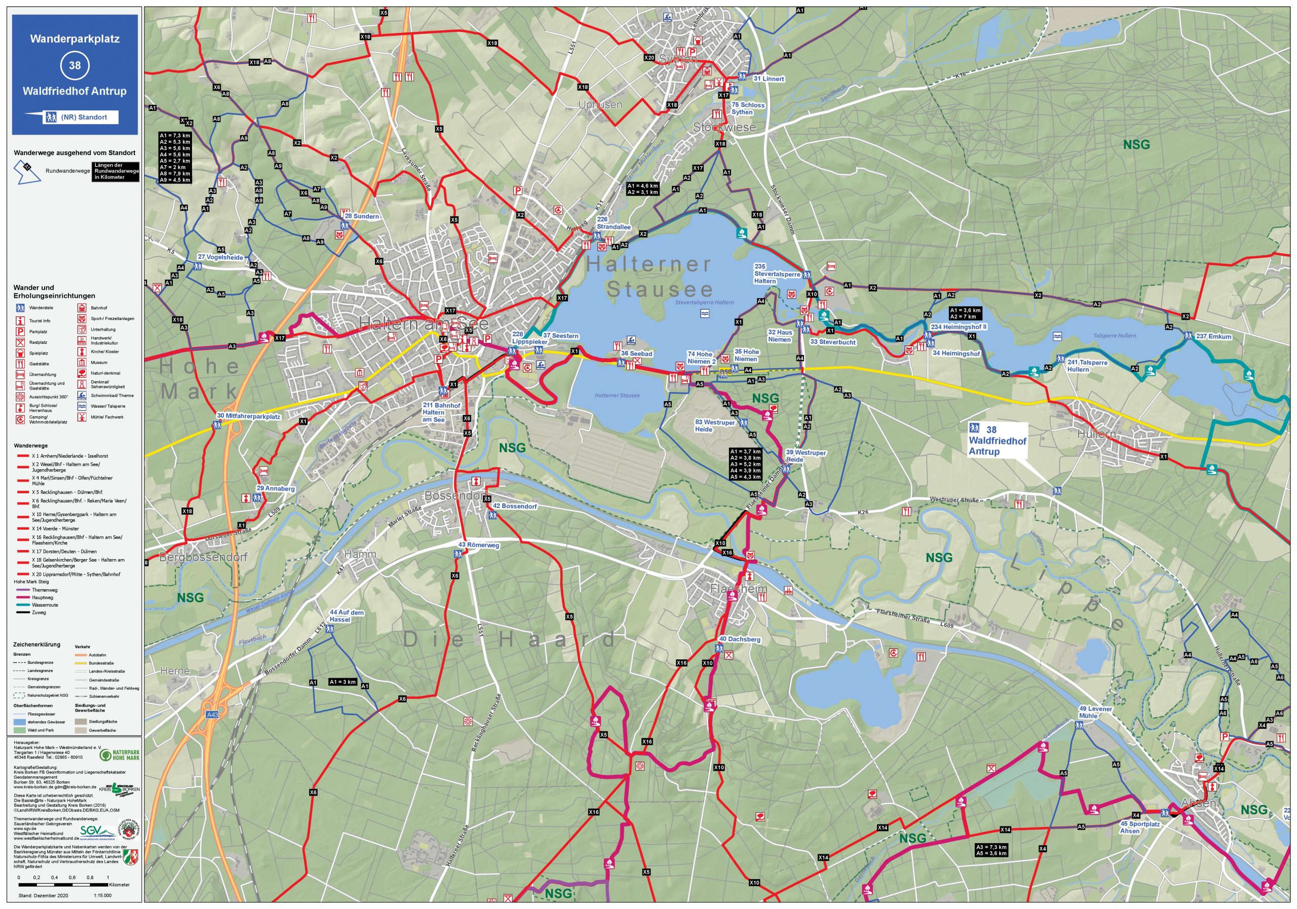
No. 38 - Antrup Forest Cemetery
Location: Antruper Strasse
PDF hiking map
Car spaces: approx. 20
Path characteristics: forest paths, dirt roads, small road (suitable for prams)
Landscape: forest, open field, reservoir (flat)
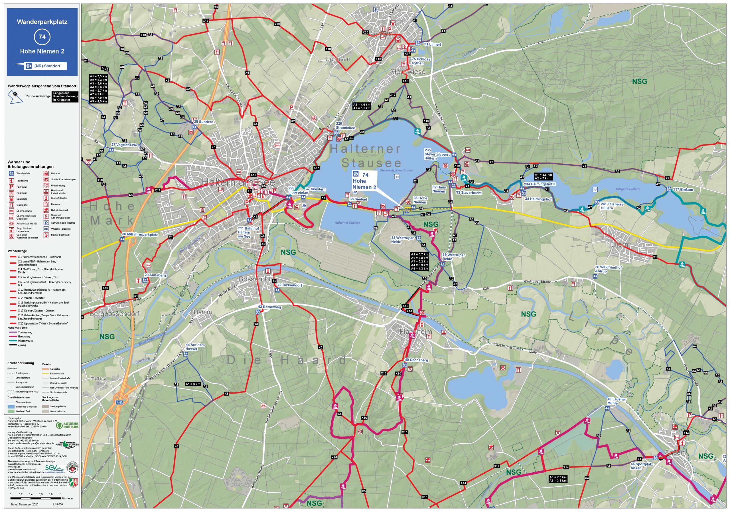
No. 74 - Hohe Niemen 2
Location: Hullerner Str. (B58), reservoir
PDF hiking map
Car spaces: approx. 102
Nature of the paths: forest paths, bank sweeps, sand paths (Westruper Heide) (outside of the heather suitable for prams)
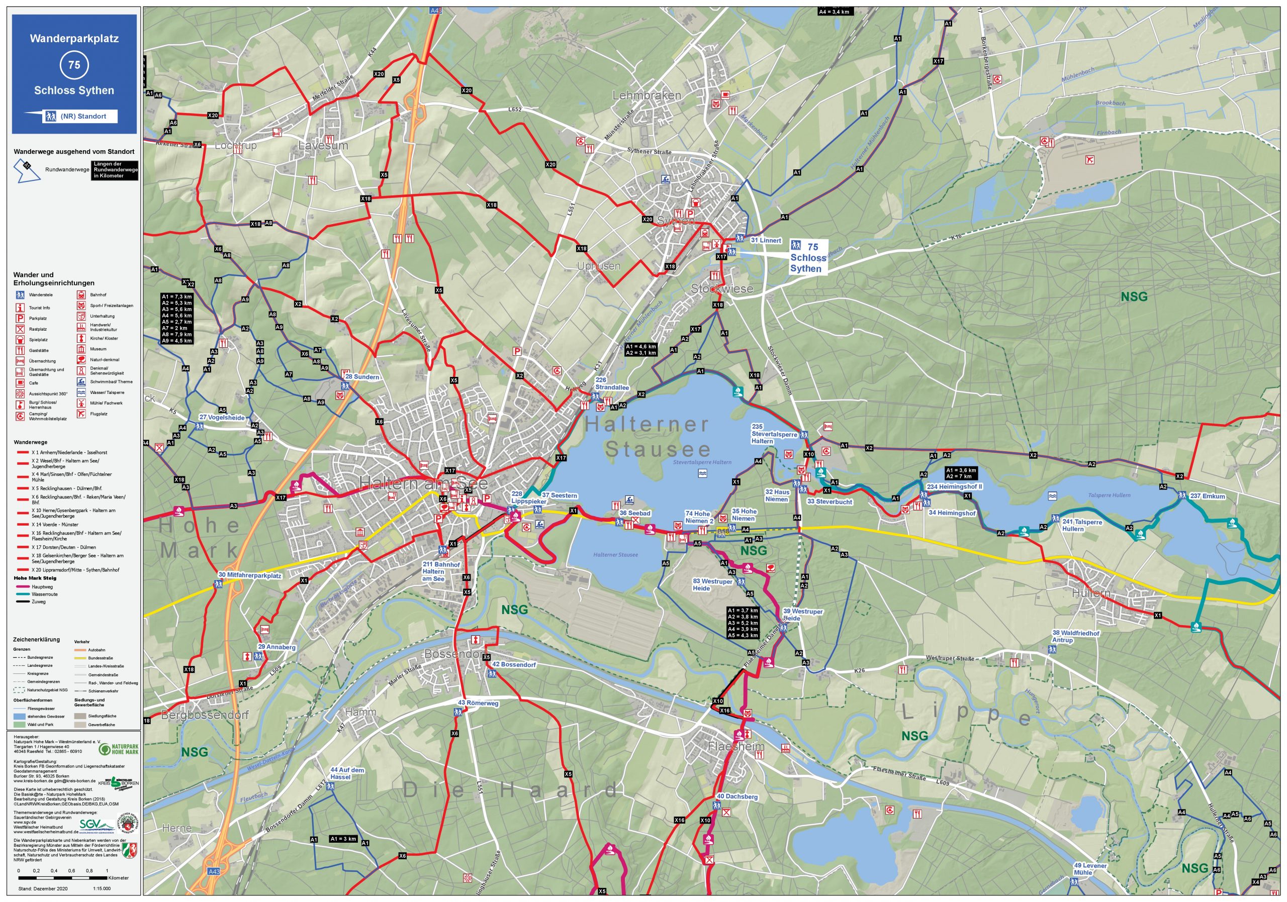
No. 75 - Sythen Castle
Location: Stockwieser Damm 25, 45721 Haltern am See
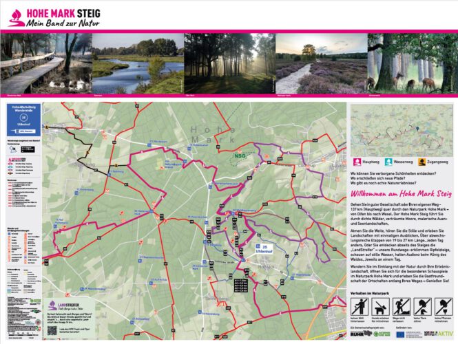
No. 25 – Uhlenhof
Location: hiking car park, Holtwicker Str. 420, 45721 Haltern am See
Naturpark High mark
Tourist Info in NaturparkhouseTiergarten Schloss Raesfeld
Tiergarten 1
46348 Raesfeld
Phone: 02865 – 609110
E-mail: np-hohemark@raesfeld.de

Follow us on the web.