My backpack
You don't have anything in your backpack at the moment.
Add destinations, sights and events by clicking this icon on individual pages:
![]()
Packed everything? Then send the backpack to yourself or your companion and set off.
The Münsterland, Niederrhein, the Metropole Ruhr. In the intersection: That WALDband - of the Naturpark High mark

Three regions - three partners - one way
The project WALDband represents the sustainable development of the Naturpark Hohe Mark as a landscape area in the transition between the three regions Metropole Ruhr, Münsterland and Niederrhein to the center.
It is an impulse project for Naturpark, which the legal predecessor of the Ruhr Regional Association launched more than 50 years ago. The regional association is, so to speak, the “father” of the Naturparks.
The Naturpark Hohe Mark as a "child" born in 1963, in addition to initiating the project, takes on the communication as well as the marketing and consolidation of the WALDbandeg.
The Landesbetrieb Wald und Holz NRW acts as the “godfather” in this community - it advises and supports this WALDband with the three regional forest offices Niederrhein, Münsterland and Ruhr area.
The Naturpark with its large forest areas is exposed to a variety of competing interests. Forestry and agriculture, nature conservation, leisure, tourism and other demands create a high usage pressure. In the project WALDband should answer the essential future questions on the forest and landscape development of the Naturparks are illuminated.
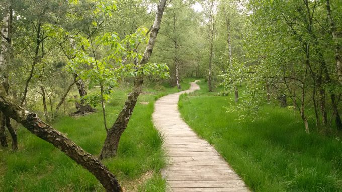
The WALDband As a project family, it consists of many individual projects that encompass nature-friendly tourism, visitor management, inclusion, climate change and biodiversity.
An early title that WALDbandes is "From patchwork quilt to vision of the future". It is precisely this feat that the three project partners in the Naturpark Hohe Mark succeded. Offers in the area were further developed, outstanding new projects were initiated, discussed with many interest groups and finally all projects were combined into a complete work in the Naturpark together - always keeping an eye on the balance between nature conservation, recreation and management!
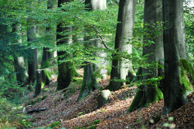
The project "Welcome to WALDband“ is in the project family of the WALDbands an overarching project to publicize the WALDband / Naturparkprojects for visitors and residents at "welcome places and service and information places" in Naturpark.
Furthermore, the service and information chain for those interested is to be improved in order to motivate them to visit various locations and offers in the Naturpark to increase. The info mobile Naturparks as a “mobile place of welcome” is to be expanded. A marketing campaign increases the media presence of the Naturparks.
The project WALDband and its sub-projects provide important impetus to strengthen the Naturparks. The continuation of the sub-projects from the project WALDband is under the umbrella of Naturparks planned.
The in this project at different locations in the Naturpark placed digital and haptic information provide comprehensive information for visitors.
The project received 90 percent funding. The money comes from the European Regional Development Fund and the state budget of North Rhine-Westphalia. 10 percent was financed with own funds.
The total costs amounted to €199.781,60.
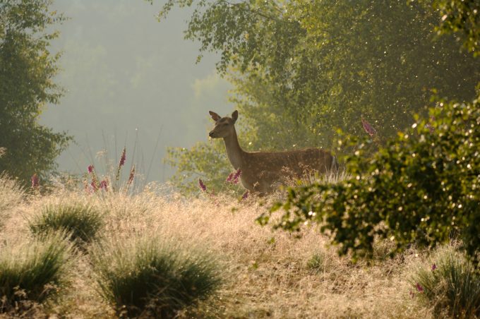
Hohe Mark Steig
The hiking path HeightMarkClimb in North Rhine-Westphalia as part of the project WALDband a new tourist quality offer with supra-regional appeal for the Naturpark Hohe Mark represents, which the existing tourist highlights in the Naturpark connects and the inter-municipal cooperation of the sub-areas Ruhr area, Münsterland and Niederrhein encourages. For the Hohe Mark Steig - designed as a long-distance hiking trail from Wesel to Olfen (or the other way around) – certification was achieved according to the criteria of the German Hiking Association. This represents added value for regional and national marketing and thus an economic factor for the NRW region.
The HeightMarkClimb leads through varied landscapes Naturparks Hohe Mark. 7 stages with a total length of approx. 150 km lead from Wesel to Olfen. A variety of natural experiences await you along the hiking trail.
In addition to the long-distance hiking trail through the entire region, there are themed loops - circular hiking trails with a length of 4 to a maximum of 20 km, the so-called LandStreifer. These form an attractive hiking offer for day trippers.
The project will be for Naturpark Hohe Mark funded at 90 percent. The funds come from funds from the European Regional Development Fund and from the state budget of North Rhine-Westphalia. 10 percent are financed with own funds. The total costs for the marketing of this hiking trail amount to around 380.000 euros.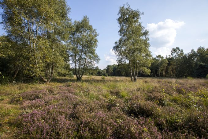
The Naturpark cooperates closely with the Regional Association Ruhr (RVR), who is the project manager for the infrastructure area Hohe Mark Steig holds. The care and maintenance of HeightMarkClimb is guaranteed by the Regionalverband Ruhr for the period of the earmarking period.
The total cost for the HeightMarkClimb amount to 1,6 million euros.
Tourist information on the HeightMarkClimb see here
The Hohe Mark RadRoute was redesigned and runs as a circular route over 280 km through the Naturpark. This means that the four thematic landscapes of the Naturparks can be better experienced as natural attractions.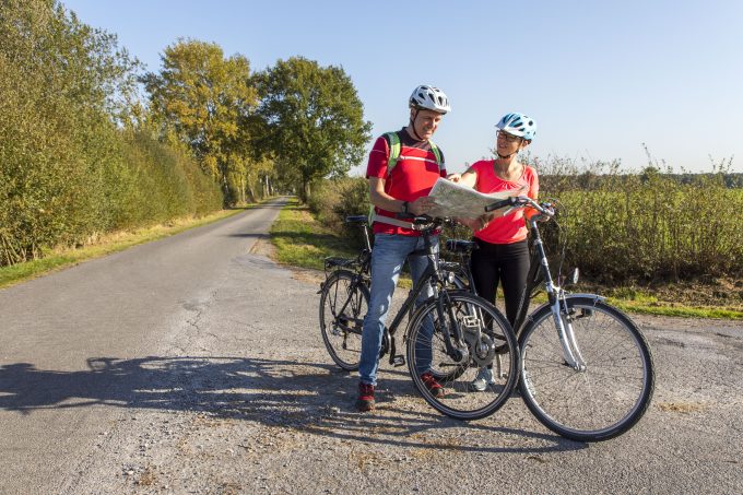
By making some adjustments to the route over the course of the route, the thematic focus of the route is also placed on experiencing nature, especially animal observation. The route, certified with four stars by the ADFC, includes attractive stopping points with a special focus on the local wildlife and natural highlights, which are staged in different ways, for example through listening stations.
Attractive day routes complete the offer. Thus, it serves Hohe Mark RadRoute thematically the building blocks of the positioning strategy of the regional tourism concept for the Naturpark High mark.
Project data:
The project received 90 percent funding. The money comes from the European Regional Development Fund and the state budget of North Rhine-Westphalia. 10 percent was financed with own funds.
The total costs amounted to €544.072,54.
From prohibition to offer
The project "From prohibition to offer“ represents in the project family of the WALDbands an overarching project to inspire and inform visitors to the WALDbandes / Naturparks.
Against the background of increasing digitalization, it is necessary to inspire and inform guests via a mobile website with target group-specific content.
The new website takes these central aspects into account.
The project WALDband and its sub-projects provide important impetus to strengthen the Naturparks. The continuation of the sub-projects from the project WALDband is under the umbrella of Naturparks anchored. For this purpose, the individual project information is used WALDbandes and the products resulting from the projects in combination with the offers of the Naturparks presented on a website.
The project received 90 percent funding. The money comes from the European Regional Development Fund and the state budget of North Rhine-Westphalia. 10 percent was financed with own funds.
The total costs amounted to €103.411.
Partner projects:
Die Haard - in implementation
The Haard is a typical example of the different needs that are placed on the forest. The interests of recreational athletes and those seeking relaxation are often at odds with those of the forest. In the course of WALDbandThere are new information offerings that consciously guide visitors into forest areas that are less sensitive.
A new mountain bike route, conscious visitor guidance and the creation of a FOREST promenade between Marl and Oer-Erkenschwick help the forest and visitors to relax.
Stimberghöhe - in implementation
The Stimberghöhe project, with a former military site and adjacent nature reserve, covers a total area of 6,9 hectares. Here, nature conservation measures such as the development and maintenance of heather areas, the formation of a light oak-birch forest, neophyte control, clearing quartzite banks and dry grass areas are carried out in order to Upgrade area.
Since the Stimberg is a well-developed and popular destination for those looking for relaxation, accompanying measures to guide and inform visitors are essential for the sustainable success of nature conservation measures.
Visitors gain insight into the constant interactions between natural development and human influence and are guided through the area on a well-designed discovery tour. Viewing platforms, steel silhouettes, information boards and a green classroom complete the concept.
Neue Wildnis Dämmerwald – completed
The project "Neue Wildnis Dämmerwald“ is located in the wilderness development area of Dawning Forest near Schermbeck. It is a forest area with old deciduous trees, which should develop into a "new" wilderness without human intervention. The aim of the area is to make a contribution to nature, species and climate protection and to involve the population in the context of wilderness and environmental education.
For this purpose, an approximately 2,5 km long, low-barrier circular path has been created, which is equipped with exciting information and interaction offers on the subject of "wilderness in the making". Starting from the “Teufelsstein” hiking car park at Malbergerstraße 105 in 46514 Schermbeck, visitors are greeted by a „Wildnistor“ welcomed. There, area-related information is conveyed via information boards. At six information points along the circular route - the "wilderness windows" - the visitor gets an insight into the emerging wilderness.
Bee meets wild boar, biodiversity project - near-natural forest edge design and monitoring to monitor success - completed
At the edge of the Haard, the forest directly meets agricultural land. These were plowed to the edge of the forest, often cultivated with maize for years and intensively fertilized with liquid manure.
However, in order to improve the biodiversity and the landscape, various agricultural products are to be planted alternately every year if possible. Stepped forest edges, provided with edge strips made of meadow herbs such as cornflower or poppy, create a smooth transition from arable to forest areas.
These measures not only benefit the forest, but also improve groundwater protection.
WALDgesichter – completed
On the initiative of the Regionalverband Ruhr (RVR), an innovative inventory and planning method was developed at the Ostwestfalen-Lippe University of Applied Sciences as part of a seminar for urban planning students in the winter semester 2015/16, led by Prof. Martin Hoelscher and Prof. Kathrin Volk so-called "raster search" in the project room WALDband accomplished. An essential feature of the "raster search" is the grid-like division of the investigation area and the consciously subjective "experience" and "inspection" of the area, which is limited to two days. Finally, the collected impressions are recorded in the form of images (photos), encounters (interviews), objects (collection), sounds/smells (recordings, notes) and much more.
On this basis, the students developed the first conceptual approaches for a regional tourism development of the area. The results are evaluated by the RVR and are taken into account for the “regional tourism concept / tourist mobility concept” in terms of identifying the area or internal marketing derived from it. In addition, a public photo competition was held.
WALDerlebnisweg Reken – completed
The WALDerlebnisweg Reken is a hiking trail with 12 adventure stations on the subject of "life of animals and plants in the forest".
In order to bring families, kindergartens and schools closer to the topics of forest and nature, the community Reken on an existing hiking trail in a wooded area Walderlebnisweg built. Already in 2012, as part of the Naturparklook in Naturpark Hohe Mark a low ropes course. This is followed by an approximately 1,4 km long hiking trail to the observation tower on Melchenberg. 12 experience stations have been set up along this path, which playfully convey interesting facts about life in the forest, energetics, types of wood, the history of the forest and forest animals.
Inclusion in the landscape – completed
The water castle Raesfeld with the nearby Naturparkhaus and the adjoining Tiergarten is an outstanding tourist attraction in the region and beyond, in whose surroundings both the experience of nature and getting to know an imposing cultural monument is possible.
However, this experience and getting to know each other was not possible for people with disabilities due to the inadequate expansion of the paths and bridges.
For example, it was not easy for wheelchair users to get over one of the bridges into the castle courtyard or to drive around one of the castle ponds. Visually impaired people did not find a guidance system to help them walk around the castle.
In order to enable all generations, and especially those with disabilities, to actively experience nature and immerse themselves in a world steeped in history, it was necessary to adapt the infrastructure around the Raesfeld moated castle and create differentiated media offers for visitors.
By changing the media used (display boards and listening stations) different senses are addressed in the visitors, which means that a larger number of people can be reached.
It was a particular challenge to coordinate the measures with the requirements for monument protection.
Regional tourism concept Naturpark Hohe Mark – completed
It became one Regional tourism concept for Naturpark Hohe Mark for the touristic reorientation and marketing of the Naturparks created.
With this concept and the resulting positioning strategy for the Naturpark Hohe Mark should the three lead products "Hohe Mark Steig","Hohe Mark Radroute" and "Hohe Mark adventure spaces" based on the key themes "change of perspective in four landscapes" and "animal experience guarantee".

Follow us on the web.