My backpack
You don't have anything in your backpack at the moment.
Add destinations, sights and events by clicking this icon on individual pages:
![]()
Packed everything? Then send the backpack to yourself or your companion and set off.
You don't have anything in your backpack at the moment.
Add destinations, sights and events by clicking this icon on individual pages:
![]()

Niederrhein
Niederrhein
Northern Ruhr area


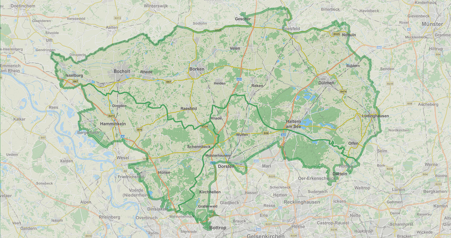
Münsterland, Ruhr area or Niederrhein, By the Naturpark Hohe Mark go many ways. Get to know regions and enjoy nature.
On this page we offer you an overview of regional hiking maps as a PDF, which you can download.
No. 440 - Castle Lüdinghausen
Location: Burg parking lot Lüdinghausen
PDF hiking map
...#133 – Dülmenhe lake
Location: To Dülmenhe See 37, 45721 Haltern am See
PDF hiking map
...No. 1 - Dahlenkamp
Location: Rhade, Dillenweg, near the Dahlenkamp sports complex
PDF hiking map
Car spaces: approx. 85
Path characteristics: forest paths, small roads (suitable for prams)
Landscape: forest, open field (flat, near town)
No. 2 - Emmelkämper Mark
Location: To the Vorwerk / B58
PDF hiking car park
...No. 104 - Kranenmeer
Location: Kranenmeer
PDF hiking map
No. 105 - At the sports center
Location: At the sports center 3a
PDF hiking map
...No. 163 Market
Location: Market on Weseler Straße in Brünen
PDF hiking map
No. 164-Brüner Str.
Location: Parking lot opposite town hall / corner of Am Sportplatz / Kerschenkamp
PDF hiking map
No. 166-Marienthal
Location: Near Haus Elmar, Marienthaler Straße parking lot, Hamminkeln-Marie…
No. 10 - Haversberg
Location: Alter Weseler Weg / Granatstrasse
PDF hiking map
Car spaces: approx. 33
Path characteristics: forest paths, dirt roads, small road (suitable for prams)
Landscape: forest, open field (hilly)
No. 16 - Hohemarkenbusch
Location: Garnet Street / Rekenhe street
PDF hiking map
...
No. 48 - Nethöfelberg
Location: To the sports facilities / Dortmund-Ems Canal
PDF hiking map
Car spaces: approx. 30
Path characteristics: dirt roads, riverside paths, small roads (suitable for prams)
Landscape: some forest, open field, canal bank (flat, near town)
No. 109 - Pröbsting leisure center
Location: Pröbstinger Busch 16
PDF hiking map
No. 110 – City Park Borken
Location: Feldmark 3
PDF hiking map
...No. 136-Bird Route
Location: Waldweg 8
PDF hiking map
No. 137- Gahlen
Location: Parking lot, Kirchstraße 60, 46514 Schermbeck
PDF hiking map
No. 141 - Malberg
Location: Malberger Strasse 105
PDF hiking map
No. 142 Devil's Stone
Location: Malberger Strasse…
No. 113 - Forest Chapel
PDF hiking map
No. 114 - Backenberg
Location: Bollgraben 1
PDF hiking map
No. 115 - Böckboom
PDF hiking map
No. 117- Train Station Reken
Location: Bahnhofstrasse 42
PDF hiking map
No. 118- Reken Surendorf…
LandStreifer – Diersfordther Forest
No. 245-hiking car park at the military cemetery
PDF hiking parking map
...No. 145-High Ward
Location: Hikers' car park at the corner of Wilhelmstr./Hohe Wardweg
PDF hiking map
No. 146-Kürbaum
Location: Bergerstrasse car park Kürbaum
PDF hiking map
No. 147-Wilhelmstr.
Location: Wilhelmstr. Hiking parking lot
PDF hiking map
No. 148- Test...
No. 125 - At the sports field
Location: Paulusstrasse 8
PDF hiking map
No. 126 - Am Tiergarten
Location: Schloßplatz 5
PDF hiking map
...
No. 101- Femeiche Raesfeld
Location: Ekhornsloh 8
PDF hiking map
No. 103- Südring Raesfeld
Location: freedom 3
PDF hiking map
...Naturpark High mark
Tourist Info in NaturparkhouseTiergarten Schloss Raesfeld
Tiergarten 1
46348 Raesfeld
Phone: 02865 – 609110
E-mail: np-hohemark@raesfeld.de

Follow us on the web.